
O1.M2.03. Process vs. Object. Working with (postindustrial) communities
Free
About this course
1. Major Phenomena
Teaching method: introductory lecture
Duration: 40 minutes
Major global socio-economic and political events have deep and long-term impacts on the micro-level of communities and individuals, affecting both the dynamics of urban life and the physical structure of the city.
Phenomena like deindustrialization or migration produce both quantitative and qualitative physical changes at the city or neighborhood scale, as a result of major social, cultural, economic, demographic changes. Why is it important for spatial designers (designers of spaces) to learn and understand these processes? How can spatial designers use and transform this knowledge into a useful instrument or a specific tool?
Discussed topics:
1/ Urban growth-de-growth relationship. The shrinkage of cities
This part describes the consequences that administrative, political, and economic major changes of the last thirty years have had on the built and social Romanian environment.
An analysis of the main post-war urbanization stages in Romania is provided, discussing the urban growth-degrowth relationship, and, implicitly, the deep demographic mutations that shape the country’s future.
Analyzed statistical data show that most Romanian cities, of different sizes and types (small touristic towns, industrial, agricultural towns, harbors by the Danube) are facing various forms of decline: socio-cultural, economic, physical, demographic. After the continuous and controlled growth of the country’s cities during communism, the Romanian cities, freed by constraints, began losing inhabitants for the first time: in the last 30 years, out of the 320 cities of Romania, 163 cities have decreased by 20%, and 62 have lost 30% of the population. While many of the areas entering a steep decline are to be found besides prosperous magnet cities, in the marginalized towns, factories, houses of culture, meeting spaces, even homes are closed or abandoned, and their inhabitants are being left behind.
All of the above have had an important impact upon the urban fabric and its built environment, which is confronted with disparities, closure of urban features. In Romania, sprawl and population decline coexist and occur simultaneously, with the expansion entailed by sprawl being mistaken for real growth as the built-up and developed areas push the boundaries of both urban and rural localities further. The most vulnerable elements in the Romanian urban network are small towns.
2/ Demographic mutations
Romania’s population is confronted today with severe aging. Never before in its last century has the negative rate been so high. Corroborated with the emigration of the young generation, and with the recent effects of the pandemics, it leads to a long-term aging of the population.
EXTERNAL MIGRATION
External migration in Romania occurred in flows of different intensities. After 2007, emigration became constant, and it is not characterized by waves and peaks anymore.
The consequences of this constant out-migration are economic, manifested in labor shortage, demographic, leading to an aging population, have a profound social impact concerning families, communities, emotional trauma, and eventually have an impact on the settlements, as well.
INTERNAL MIGRATION
While the communist era was defined by a rural-urban exodus and the urbanization of the rural, at a time when modernization was synonymous with urbanization, the tendencies today are migration, from urban to rural (with an impact on the rural character), and at the same time, the ruralization of a portion of the urban segment.
3/ Planner`s attitude: making use of the urban challenges
Romanian cities are trying to adapt to the globalization model and they are doing it at the cost of spatial and social divisions. This applies to most European postcommunist situations.
Many of the areas entering a steep decline are to be found besides prosperous magnet cities. While the public discourse is always about the powerful, the major, the large, the Romanian reality is not even characterized by that, but rather by the smaller, domestic scale-that reflects both in the built environment and in the human relationships. Shrinkage is often ignored by the local administrations, which blocks any possible reforms, observed without proper communication, or is being countered (but not understood in the specific context), in an approach based on competition which might lead to failed investments.
This public discourse of disregard towards shrinking cities makes them seem unattractive even for architects and urban planners.
NEGATIVELY PERCEIVED ASPECTS:
-
- the decreasing population
- aging of population
- higher rate of vacancies, empty building infrastructure
- heterogeneous texture/ voids
- economic problems, lack of jobs
POSSIBLE EFFECTS:
-
- Sustainability.
Shrinking Cities have the potential to be more sustainable in the future: the decreasing population and the higher rate of vacancies creates potential for a reduction of build‐up area and infrastructure that can be reused
* Landscape is an important tool to work with: the empty spaces can become permeable areas and be linked in green corridors. Landscape can have multiple roles: (a) as a planning and a design tool, or (b) productive: urban farming, community gardens
-
- Active ageing
People can continue to participate in the formal labor market, engage in unpaid productive activities (such as care provision to family members and volunteering), and live healthy, independent and secure lives as they age.
-
- New form of density
This refers to the new spatial qualities that the Shrinking Cities develop, regarding space or buildings.
-
- Heritage. Valuing unused or forgotten existing resources
Most of the Shrinking Cities have resources that are sometimes forgotten which must be cultivated and developed. These values can be very diverse: historical buildings, industrial heritage, natural assets or even immaterial heritage, like traditions.
-
- Innovation and creativity
A wide variety of new developments in popular and high culture emerge from these urban crisis sites. Shrinking Cities are often the starting points for cultural innovation, spontaneous or organized artistic manifestations.
2. Interdisciplinarity
Teaching method: lecture
Duration: 40 minutes
Developing community building processes, which includes also developing form-making processes involves most of the times different kinds of knowledge. Community building processes are better developed in teams that include, among others, architects, urban planners, anthropologists, sociologists, landscape architects. As a desired working method, interdisciplinarity is very easy to project but very hard to obtain.
This lecture discusses the need for an interdisciplinary approach in planning and how this intersectional knowledge can be used in developing community projects and processes. It further explores, by example, projects made by teams that include architects, urban planners, anthropologists, sociologists, landscape architects, historians and that make use also of local knowledge.
The examples reveal what can the actors involved learn from each other in the framework of these processes and how important these various perspectives are in collectively drafting a problem definition.
1/ Interdisciplinarity in research projects open to the public
The three research projects presented, conceived by architects, but pursued in an interdisciplinary team and meant to present a complex phenomenon / urban story to the general public.
Shrinking Cities in Romania
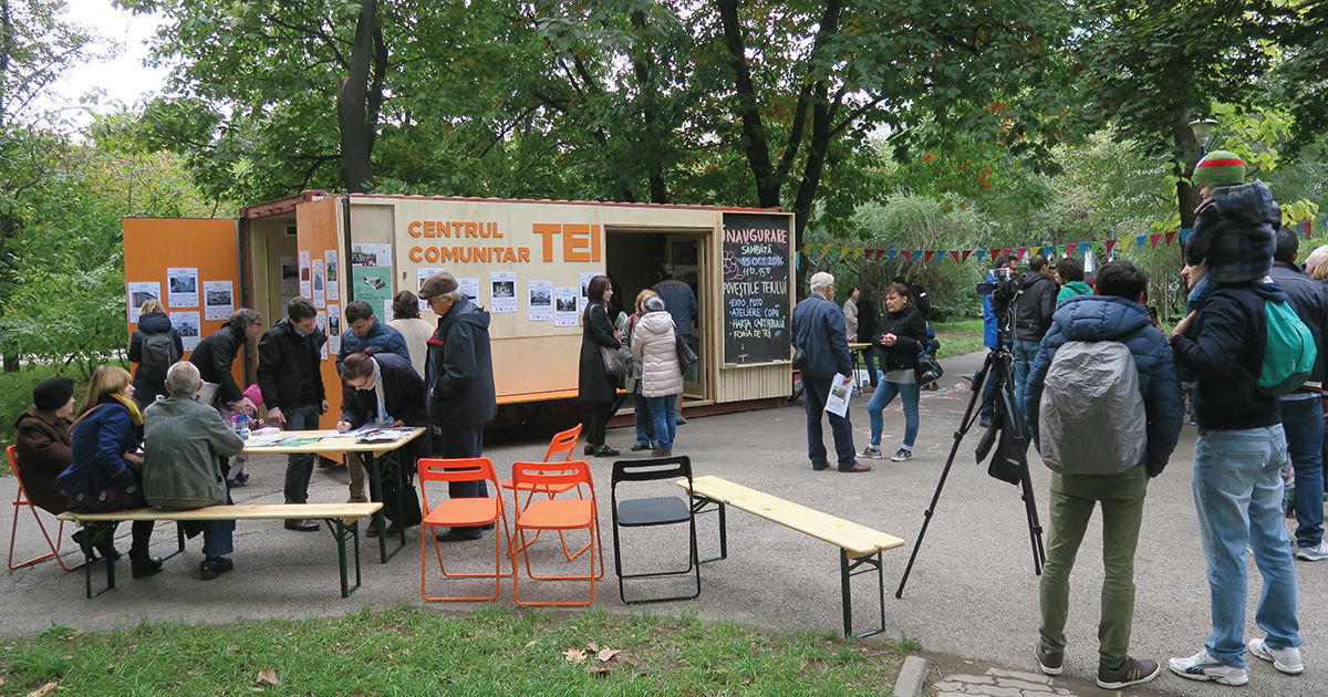
The ongoing project “Shrinking Cities in Romania” took shape after a research process started in 2009, discussing the shrinkage of Romanian cities as a widespread phenomenon. The project has been since the beginning a pioneering initiative in Romania to raise awareness about an acute and pervasive, yet too little discussed matter. Since the beginning, the project has been trying to open itself to the public and to create a positive perspective on a negative and very complex phenomenon, one that produces both quantitative and qualitative changes at the city or neighborhood scale. As these changes include social and cultural changes, physical, economic and demographic changes, the project took shape as an interdisciplinary one, gathering a large group of academics and researchers in the fields of architecture, urban planning, economy, sociology, anthropology, artists, architects, urban planners and, quite important, hosting several recurring events that involved the audience.
On Housing. Collective Housing between Process and Product
Given today’s context in which mass housing has increasingly become a marketing product, intensely advertised and wrapped in the most attractive packaging, the ON HOUSING project provides a critical perspective on the various actors involved: administrations, developers, architects, and resident/ end-user. The voices of these actors are introduced along two different lines: the informative one, which outlines dwelling as process, and the experiential one, which points to dwelling as product. An invitation to reflect on present and future perspectives on the quality of housing, this exhibition consistently refers to those defining moments from the past of collective housing and debates in a contemporary key topics such as the right to housing; individuality and community; the directions followed today by the architectural project; economic rationality; marketing vs. reality. Thanks to its interdisciplinary approach, ON HOUSING focuses on setting up a dialog between the actors involved in the production of housing. In the long term, the purpose of this endeavor is to help the residents themselves become increasingly involved in this process.
Uranus Now. Urban and community project
The project focuses on the Uranus – Izvor area, as the most representative for Ceausescu’s “great project”: here, a piece of historic city was almost completely erased (from buildings and streets, to topography) and replaced with an assembly of enormous buildings, forbidden areas and wastelands. Along with the specific research, two essential questions were asked: How do you present an annihilated world? How do you connect the inhabitants’ memories and stories of the old streets and houses with the current space? The project`s keyword was co-presence: a merger of today’s reality with the former one.
The project is about the living history and the community spirit, about the sometimes invisible connections between radically different ages. December 22, 1989 marked not only the fall of the Ceaușescu regime, but also the end of his tabula rasa project for Romanian cities. Thirty years on, the collective memory of these destructions is fading away, while the aggression against the cities goes on, even if in the opposite paradigm—that of ultraliberal development. In an interdisciplinary approach (architect-sociologist-anthropologist and dweller), the project combines three critical themes: an excursion into architectural-urban and personal history, a critique of current developments, and a contribution to a more balanced and responsible urban development of Romanian cities, one that would also include history and take it further.
3. Working with Communities
Teaching method: lecture
Duration: 40 minutes
Most of the time the planning processes involve architects, urban planners and designers responding to an existing brief. Interaction with the future users of a space or building is kept to a minimum, with a focus placed on the form making mechanisms of the building process. The production of space thus becomes the closed and controlled domain of the architect and designer. Nevertheless, there are other ways of practicing architecture as more than a service to be provided. And other ways of working with communities and not in the name of communities or for communities. Other methods that emphasize processes, networks and relations, as well as buildings and spaces. Methods that define the design practice as a collaborative and shared process, where the community becomes a partner in the process and the architect learns how to let go of some of the control, in order to empower others to be part of the process.
Literature points to a key ingredient of successful strategic planning as a process involving citizens, the public sector and civil society. Especially in marginalized areas, it is stated that right from the beginning ideas should be developed with the people. The city could give up central control and give it to neighborhoods and communities instead, trusting that locals know these areas best and can therefore come up with plans for their future.
In the context of social mechanisms undergoing profound changes, can the communities and the spaces they use be reconstructed in a collaborative way?
How do you collectively draft a problem definition?
In the absence of “top-down” concerns, the selected cities present “bottom-up” initiatives, which shed new light on the existing reality and work directly with the local community. The advantage of such an initiative is that it mirrors real problems and needs, and in the recent years, a solid network of initiatives has taken shape in Romania. Representative for some categories of cities, the examples formulate and initiate constructive ways of approaching these problems and imagine a future for these marginalized places, by making use of shrinkage and transforming their apparently negative features into working tools and concepts.
Understand the needs of the citizens. Instruments and programs need to address the real demands of communities. They might not be employment opportunities, or skills, but a demand for services in health, education, environment, housing and entertainment- overall, a demand for a higher quality of urban life obtained by carefully investigating the inhabitants’ needs.
Strengthen the communities. To overcome the consequences of shrinkage, joint action is needed: local authorities need to involve citizens in governance processes and the social economy, and help create co-services, also with neighboring cities. Achieving a new form of collective action produces outcomes that neither the state nor the market could have achieved on its own, but civic engagement is not something that can be dictated. Civil society needs to be empowered.
Further on, the discourse goes back to the issues discussed in Lecture 1 and presents a selection of long-term projects that were responding to the possible positive effects of shrinkage. Focusing on Planeta Petrila, the examples depicted are born within the communities and further pursued in a collaborative manner.
1/ LANDSCAPE AS A PLANNING TOOL/ Studio Govora
2/ SCALE DOWN AND SLOW DOWN / Urbanium Turnu Măgurele
3/ BUILT DENSITY REPLACED BY SOCIAL DENSITY / Brăila LAB
4/ HERITAGE. VALUING UNUSED OR FORGOTTEN EXISTING RESOURCES / Herculane Project
5/ INNOVATION AND CREATIVITY / Planeta Petrila
Planeta Petrila
The town of Petrila in the Jiu Valley, like all the former Romanian industrial cities, is going through a process of finding a reason to be, struggling between the pre-mining identity, memories of the glory age, and the post-industrial painful transformations. The colony, founded with the opening of the first coal mine in 1859, grew along with the development of mines, the closure process of which ended in 2015.
Learning, in 2011, of the national program to close the non-profitable mines, which provides for the total demolition of the buildings belonging to Petrila Mine, the oldest mine in the Valley, the local artist Ion Barbu forms a huge team with whom he starts an action to save them. After several years of efforts, various interdisciplinary projects and multiple artistic manifestos, the mining ensemble becomes a class “A” monument and is thus partially spared. The future remains uncertain, but the discussion about industrial heritage as a resource, on a national scale, is officially open. Beyond resignation or fatalism, attitudes encountered especially in the collective discourse, the city continues to slowly shrink, a result of the diminution of the economic activities that initially determined its appearance. In this landscape, the interventions on the industrial heritage are closely related to assuming a general program of regeneration through culture.
A bottom-up approach, started ten years ago, to which the local administration joins along the way, shows the complicated and long-lasting mechanisms of the conversion. The project began as a bottom-up manifesto against imminent demolition and tried to prove to the authorities that industrial heritage can be a source for regeneration in a town with serious social and economic problems.
In order to manage the regeneration project, the Planeta Petrila Association is established—an entity formed by the local administration, the civil society, former miners, architects, and urban planners. Over the years, the work divided into two complementary directions: one that focused on industrial heritage in an integrated manner, and one that migrated toward community-based projects.
It is probably the largest participatory project ever carried out in Romania, initiated by an internationally recognized local artist, taken over by a group of architects in a snowball effect, and carried forward together with a growing team of specialists, locals, and external participants, most of them volunteers.
*Depiction of micro-projects developed within the community at Petrila:
-
- Developing Pompadou Center 2014
- Dining on the bridge, Days of Industrial Heritage 2015
- Conversion for the first monument building: The Old Preparation with the Coal Washery
4. Intangible Values
(an updated and extended version of the “Deep Mapping” method developed by Matthias Einhoff)
Field research is an important step in trying to have an in-depth understanding of a socio-spatial situation. It is also a key component of inclusive and collaborative design processes towards a more democratic way of regenerating urban areas. Direct experience of the conditions that are inherent in a place and talking to the people that are part of the local community will help students to identify the impacts major socio-economic and political events have at the micro-level of communities and individuals. The interdisciplinary approach of the research workshop will combine different types of knowledge (specialist and local) aiming to have an expanded and comprehensive view of the problems that the community is facing. The tools and instruments used for the workshop are based on a collaborative methodology of understanding a situation, and identifying problems and finding possible answers together with the inhabitants.
The first step of the method is to select an area of the city to be studied. The selected territory should be representative for the urban, social, demographic and cultural reality of the city. The area should be selected, if possible, considering its history as part of the city. The studied area should be large enough in order to be representative and to fit all the students’ teams, and should be small enough for the students to completely survey it.
Part 1. Collecting narratives
Teaching method: semi-structured interviews, photography, direct observation
Duration: 240 minutes
In order to get a more in-depth understanding of the social situation of the neighborhood, he students, divided in teams of 2 to 3 people, will interact with 3 inhabitants of the area and collect a personal story and a portrait of each.
The collected narratives will help them get a glimpse into how personal histories are related to the built environment and how they both influence each other.
The students will select people according to their availability and willingness to share their stories. The people should be as diverse as possible regarding their age, gender, social and cultural background (if possible). In this way the collected narratives will be various and they will help build a better image of the community.
The semi-structured interviews will be based on and will follow the main topic of the course. The open discussion between the students and the inhabitants should emphasize the connection between the city, its people and the industry, both in the past and present: What, where and how was the industry present in the city and in the region? How has this presence influenced the urban fabric and the social tissue of the city? What was the social dynamic of the community? How has this dynamic changed today? What changed in the city and in the community after deindustrialization? Another focus of the discussion should be on the personal and collective histories that are connected to the studied place: How, when and why these people moved here? How do they live here? What spaces do they use? What places do they like and don’t like? What areas and what itineraries they use?
The photographs of the interviewed inhabitants will help the students to better represent the stories they collect, and will visually connect people to their living environment. The places where the photos will be taken should be chosen by the interviewed people and should have a connection to the stories they tell.
In Jimbolia: Futok neighborhood was chosen as the site for collecting stories due to its history as a part of the city that was developed by the Bohn brick factory. Many of the houses in Futok were inhabited by the initial factory workers. For Jimbolia Summer School students had to collect 3 types of stories: one about the Futok neighborhood, one about the brick factories that are now demolished, and one about the lakes in the area, which were part of the industrial process.
Part 2. Collecting situations
Teaching method: mapping, photography, drawing, collecting objects
Duration: 240 minutes
The students, divided in the same teams of 2 to 3 people, will collect 3 objects found in the neighborhood or that they receive from the inhabitants, and will draw 3 maps of 3 places in the area.
The found or given objects are a material connection with the neighborhood. They represent traces of the lives of the community. Students will have to imagine what the object was, or what it was used for, or where and how it might have been used. If they collect objects given by the locals, students will have to find the story behind the object and the reasons why the object is important for the people.
The 3 maps can represent places described during the interviews or places that students discover are important in the neighborhood and for the subject of the course. Maps can depict spatial characteristics of a place and also stories or events connected to that place and to the people that are bound to it. The overlapping of material and intangible features of a place will help the students to better grasp the interconnectivities between people and spaces. The 3 spatial situations can be illustrated in any technique, and at any scale. The non-scientific and non-specialized map will be used as a tool and not as a purpose in itself.
In Jimbolia: Bricks and roof tiles were the most common objects found by the students around the neighborhood, as the city was an important brick and roof tile manufacturing center. Many inhabitants also gave students local products like fruits, aromatic plants and jam jars. Thus, the collection of objects acted out as a small and temporary part of the past and present Futok neighborhood. The maps collected small pieces of personal stories of the people, and some forgotten histories of the neighborhood.
Part 3. Representing, exhibiting and discussing
Teaching method: collective building of an oversized map
Duration: 240 minutes
The last element of the exercise is the collective map. The stories, the photographs, the objects and the maps collected during the previous phases will be placed on an oversized map, drawn on the floor and walls of an interior room. The archipelago of narratives, objects and situations will showcase both the material and the invisible infrastructure of the area. The spatial ethnography of the place and its people exhibited on the oversized map will help students to better visualize and understand the relations between spaces and people.
In Jimbolia: The grid structure of the urban tissue was drawn on the floor and walls of a room in the Cultural Center. Students placed on the map objects they found, things that people gave them (mainly fruits or food produced by them), printed photographs of the people together with transcripts from the interviews, drawings and maps of places and situations important for the inhabitants. The most common objects were the material remnants of the brick industry that was an important part of the town’s history and development. Bricks and roof tiles were present everywhere in the Futok neighborhood: on the pavement, part of the houses and fences, on the piles of leftovers scattered around the urban landscape. The food products highlighted the rural practices still present and the hospitality of the people.
References
- Arnstein, S. R.(1969) “A Ladder Of Citizen Participation” in Journal of the American Planning Association 35:4, pp. 216-224.
- Babbie, E. R. (2012) The Practice of Social Research. Belmont: Wadsworth Publishing.
- Blundell Jones, P., Petrescu, D. and Till, J. (eds.) (2009) Architecture and Participation. London and New York: Spon Press.
- Genz, C. and Lucas-Drogan, D. (2018) “Decoding Mapping as Practice. An interdisciplinary approach in Architecture and Urban Anthropology” in Urban Transcripts Journal 1:4.
- Ghenciulescu, Ș.,D. Hasnaș, I. Păun Constantinescu,(eds.) (2021) “Uranus Now. Urban and community project, Ion Mincu” University Publishing House, Bucharest
- Greenwood, D. J. and Levin, M. (2007) Introduction to Action Research. Social research for Social Change. Thousand Oaks, London and New Delhi: Sage Publications.
- Krivy, M. and Kaminer, T. (2013) “Introduction: The Participatory Turn in Urbanism” in Footprint 13, pp. 1-6.
- Oswalt, P., (2006) Shrinking Cities, Vol. 1. International Research, Ostfildern-Ruit, Germania, Hatje Cantz Verlag;
- Oswalt, P., (2006) Shrinking Cities Vol. 2. Interventions, Ostfildern-Ruit, Germania, Hatje Cantz Verlag;
- Oswalt, P., & T. Rieniets, (2006) Atlas der schrumpfenden Städte (2006), îngrijit de Elke Beyer, Anke Hagemann, Kristina Herresthal, Henning Schirmel, ed. Hatje Cantz, Ostfildern;
- Păun Constantinescu, I.(ed.) (2019), Shrinking Cities in Romania / Orașe românești în declin, Vol. 1: Research and Analysis / O cercetare critică; Vol. 2: Responses and Interventions / Reacții și intervenții, Editor: I, DOM publishers, Berlin & Editura MNAC, București.
- Perkins, C. (2009) “Performative and Embodied Mapping”, in Kitchin, R. and Trift,N. (eds.), International Encyclopedia of Human Geography, Amsterdam and Oxford: Elsevier Science.
- Stanilov, K. (2010). The Post-Socialist City: Urban Form and Space Transformations in Central and Eastern Europe after Socialism – London: Springer..
- Swann, C. (2002) “Action Research and the Practice of Design” in Design Issues 18:1, pp. 49-61.
- Tait, S. (2011) “A diagram for co-participation” in Art & the Public Sphere 1:3, pp. 279-292.
- Watson, R. (2009) “Mapping and Contemporary Art” in The Cartographic Journal 46:4, pp. 293-307.
- ***Fading Borders, catalogue of the Romanian Pavilion at the Venice Architecture Biennale 2021 by Poster Architects, Ideilagram and Teleleu
- *** On Housing. Collective Housing: In-between Product and Process, catalogue of the exhibition by Ideilagram
Other Instructors
Alexandru BELENYI
Researcher
Irina TULBURE
Assistant Professor
Irina BĂNCESCU
Assistant Professor

Ilinca PĂUN CONSTANTINESCU
Teaching Assistant
Cristian BORCAN
Teaching Assistant

Cristian BĂDESCU
Teaching Assistant
Syllabus
Architectural education focuses mostly on finished products and rarely on processes and questions on how and for whom buildings and spaces are built. The emphasis on objects, developed in the school`s laboratory environment, is pursued afterwards in the architectural practice, and results in buildings, spaces and strategies being often designed outside their specific cultural, economic, political and social contexts. Opening to the contingencies and dependencies inherent to the contemporary urban phenomena and nurturing collaborative processes can be a much-needed way to redefine the architectural profession. Therefore, the course highlights the transformative agency of architecture as a shared undertaking between professionals and communities by providing a critical, engaged and action-oriented methodology. The course showcases examples of processes developed between architects, urban planners, anthropologists and different communities through collaborative and knowledge exchange actions. Thus, the proposed interdisciplinary approach of the course offers the framework and the tools to understand, engage and work within the conditions of a real community and place. The course consists of three lectures that offer basic theoretical notions and a full day research practice within a real community. The lectures are structured around three major topics: understanding the major contemporary urban phenomena (1), the need for an interdisciplinary approach in planning (2), learning how to work with communities (3). During the workshop the students will learn and experience how to use different methods to interact with a real situation and a real community.
O1.M2 OBJECTIVE AND SUBJECTIVE SKILLS IN INTERPRETING TERITORIAL NETWORKS
O1.M2.03 On borders: a theoretical research framework. Border as a working instrument for analysis and design
Type of format
Lecture & Workshop
Duration
DAY 1 40 min lecture 1 (theoretical notions) 40 min lecture 2 (theoretical notions) 40 min lecture 3 (theoretical notions) DAY 1+2 720 min workshop (field research)
Possible connections (with other schools / presented topics)
UAUIM O1. M1.03 Transformation and growth within the strict confines of the grid: economy, infrastructure and society O1 M2. 04. Speaking with communities. How to conduct an interview with local actors. O1. M3.01. Recognition by small scale intervention
Main purpose & objectives
The main purpose of this course is for students to reflect upon the turning point of the architectural profession, as a needed collaborative and interdisciplinary process. In order to gain an understanding of the design practice as an open-ended, collaborative and shared process, students need to: - learn about major political, economic, social events of the postsocialist world - connect those major events to the various ways they have affected the urban fabric, the dynamic of the urban life and the personal narratives of the members of the community - understand the importance of cooperation, in the planning process, with other fields - understand the significance of co-creating a process that involves also the community - gain the ability to collectively draft a problem definition - participate, within a real community, to a project that would respond to the identified problem In the end, the objective is for students to: - understand the importance, from the perspective of a spatial designer, to learn about and understand specific urban problems generated by societal changes - comprehend the expanded understanding of architecture and spatial practices - reflect on how spatial designers can use and transform this knowledge into a useful instrument or a specific tool
Skills acquired
D4 Ability to gather information, define problems, apply analyses and critical judgment and formulate strategies for action KC1 Ability to work with historical and cultural precedents in local and world architecture KC3 Understanding of the heritage issues in the built environment KS1 Ability to act with knowledge of society, and to work with users that represent society's needs KS3 Understanding of the social context in which built environments are procured, and issues of accessibility and access KS5 Awareness of philosophy, politics and ethics as related to architecture
Contents and teaching methods
1. Major Phenomena teaching method: lecture Major global socio-economic and political events have deep and long-term impacts on the micro-level of communities and individuals. Phenomena like deindustrialization or migration affect both the dynamics of urban life and the physical structure of the city. Why is it important for spatial designers (designers of spaces) to learn and understand these processes? How can spatial designers use and transform this knowledge into a useful instrument or a specific tool? 2. Interdisciplinarity teaching method: lecture Developing community building processes, which includes also developing form-making processes involves most of the times different kinds of knowledge. Community building processes are better developed in teams that include, among others, architects, urban planners, anthropologists, sociologists, landscape architects. As a desired working method, interdisciplinarity is very easy to project but very hard to obtain. What can we learn from each other in the framework of these processes? How can we use this intersectional knowledge when we work with a community? 3. Working with Communities teaching method: lecture The last theoretical part of the course has as a topic design practice as a collaborative and shared process. While architects, urban planners and designers are trained to provide services and to be part of a process that ends up in a built space or a building, the discussion focuses on a design practice where the community becomes a partner in the process and the architect learns how to share in order to empower others to be part of the process. 4. Intangible Values teaching method: field research (an updated and extended version of the “Deep Mapping” method developed by Matthias Einhoff) During the workshop the students will engage a specific area and its particular community using tools and instruments based on a field research methodology. Through semi-structured interviews, mapping, direct observation, photography and the collection of objects, the participants will produce a spatial ethnography of the area and of its inhabitants’ histories. The collected data (photographs, stories, drawings, maps, objects) will be placed on an indoor oversized map of the area in order to better visualize the context. The grounded research approach will help students to better understand the social and material context that they are studying and working with.
Reviews
Lorem Ipsn gravida nibh vel velit auctor aliquet. Aenean sollicitudin, lorem quis bibendum auci elit consequat ipsutis sem nibh id elit. Duis sed odio sit amet nibh vulputate cursus a sit amet mauris. Morbi accumsan ipsum velit. Nam nec tellus a odio tincidunt auctor a ornare odio. Sed non mauris vitae erat consequat auctor eu in elit.
Members
Lorem Ipsn gravida nibh vel velit auctor aliquet. Aenean sollicitudin, lorem quis bibendum auci elit consequat ipsutis sem nibh id elit. Duis sed odio sit amet nibh vulputate cursus a sit amet mauris. Morbi accumsan ipsum velit. Nam nec tellus a odio tincidunt auctor a ornare odio. Sed non mauris vitae erat consequat auctor eu in elit.