O1.M3.02.02. Working with the (invisible) built heritage
Free

About this course
Chapter 1. Layers of recognition
Teaching method: workshop
Duration: 420 min
According to our method, a deep understanding of the site is essential during the process of architectural design. Therefore, the design process starts with research. During this research, we collect information about the history, society, climate, economy, topography, nature, etc. of the site. We define the information as different layers of the place, which have connection and relation with each other. In order to find the starting point of the design, we have to find the connection among the layers. Because of the changing world and the various challenges, we have to continuously improve the methods of recognition and the way of information processing. The new technologies give opportunities to develop new methods of exploration of the sites and the new requests, like climate change, are made new design questions. So, the number of layers of places are constantly changing. We always need to find the relevant layers, which could lead to defining the real problems. As a result of this method, the students understand the context of the site and can find right questions and answers of the design.
The recognition is made in three different levels which can describe the different ways one can understand the surrounding and its meanings. These three levels are related to the level of the personal connection to the subject of the investigated context. The first in this term is the level of the research on the material nature of the subject (in our case of the architectural context), the second is the social meaning attached to the subject of the investigation and the third level is the description of the personal narrative of the task and the information obtained from the previous research itself.
As working method, we can describe these three level as the following:
-
- The first, the research of the material nature of the investigated context.
It is always measurable information. Here we find the surveys, the geographical context, the natural surrounding, the landscape or the built context. Everything that we can learn and understand by surveying and analysing physical data. We can use the classical methods (hand-drawn manuals and tape) or the most innovative solutions (drones, SfM, laser-scanning etc.) which will only be able to show us the physical “body” of the investigated context.
-
- The second, the research of the social meaning of the investigated context.
Whether it is an urban context or a single structure in the middle of nowhere, there must be a secondary (often almost hidden) narrative attached to it, which is always related to the social meaning of the subject. The social meaning can be practically anything, sometimes far from the original purpose of the structure or building. It is more often closely related to historical, cultural, religious or economical issues which one can reveal only by doing deeper, theoretical analysis. The tools we recommend to use in this level are basically the classical researchers methods: archives, bibliographical resources, interviews etc. It is now a more personal knowledge more related to the personal level, but it is still a common ground, influenced mostly by the whole society.
-
- The third level is the personal narrative of the investigation.
It is mostly the most questionable and most difficult to describe in a design method. However, it is the most important phase as it is the essence of the two previous levels condensed through the personality of the author itself. Every piece of knowledge obtained before in the other levels is fitted to the bigger picture by adapting them to the personal narrative of the one who made the research. It is not ever just pure recognition it is more: intuition, evaluation, critical thinking. In one word it is the first step of creating.
Our methodology is based on the systematic investigation of these three levels on different scales. These different scales could be described also as different layers of the territory and the built context. The result of every design task should be a building (or at least a structure or artifact with a certain functional approach understandable in architectural or urban context), but we consider it important to start a survey of the broader and wider surroundings or in our case, from a regional perspective, and then go closer and closer to the smaller scale of the precise architectural intervention. It is highlighted in our institutional methodology that we invite our students to experience a previously mentioned multi-leveled, multiscaled investigation process before they start the design.
Our proposal is combined by three different levels based on the different scales of investigation and intervention. Please note, that the methodology and toolkit is related to the different levels, not to the different scales, so we can apply the same process to every different scale as we can consider that every level described before can be understood in every layer/scale.
1. The regional/general theoretical scale:
The investigation of the region and the wider theoretical context. The differences of land use, the planting of the settlements. Survey the different reasons and impacts on the development of the cultural landscape (social, economical, ethnical etc.) and their appearance in urbanism and architecture.
As a starting point we propose to the participants (students) to find the broader context of the future design task. The scale of the investigated context should be variable regarding the scale of the objective of the future design proposal. We can say if for example the objective was designing urban furniture it is quite pointless to start investigating the regional scale, but better the urban and environmental scale should be this widest context on which our proposal should have an impact and backward. Generally we should say that first of all we have to find the largest context which has to have an impact on our design and which shall be “upgraded” by the impact of the future intervention. This context can be interpreted also in theoretical terms as for example in ethnical, social, religious, economical etc. sense.
On-site: For the example taken from Jimbolia this contextual investigation should mean the research made on the whole Banat region, considering geographical, historical, ethnographical, religious, economical and ethincal information.
2. The settlement/directly connected contextual scale.
The investigation of the context which actually should mean a more or less direct physical connection to the subject of the future proposal. It is possible that this “physical connection” should be understood as the proposal is part of a larger, not necessarily visible but existing system of infrastructure, urban pattern, functional context etc. The difference between the regional/general context of the 1st point is that in the case of this layer the scale should have an impact on a defined group of the society. This way we can clarify the actual position of our proposal and the relevancy of that.
On-site: The investigation of Jimbolia’s urban structure and its surroundings. For example the survey of the remains of the former canalization system which is not in use for several decades but is still clearly visible in the structure of the settlement, it is still a barrier and a limit for the village, seen perfectly for example from the satellite images of Google Earth.
3. The one building (the personal) scale
The most detailed scale-layer is more or less analogous to the personal level recognition. In this case the subject of the investigation is just the context which is in direct physical connection with the subject of the proposal: the plot, the neighbours etc. In this scale the personality and individual narratives gain more importance as it is the case in the details of the facades or as we understand here that a house or a structure shows us yet more as an individual and not just a part of a greater mass.
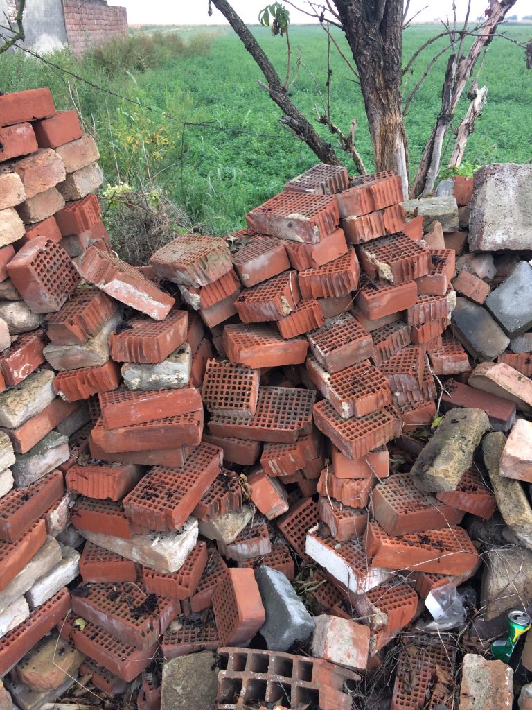
On-site: For example in Jimbolia there are many possible solutions to that topic, however there are two different proposal considered as the most interesting by us: one is the site and remains of the former brick factory, the other is the site of the former Csekonics Castle on the fields. Both of them have mostly (or in the case of the castle totally) disappeared by the time, but on the site their existence can be noticed and should be signed. These two topics are ideals also to show and understand the importance of the layers and scales or the levels of recognition mentioned before, as they all are examples (and witnesses and victims) of how geography, history, economy, sociology etc. defines and modify architecture and urbanism.
Chapter 2+3. Interventions
Teaching method: workshop
Duration: 2×420 min
One is the research and the exploration of the town and its historical-architectural context and the other is the real-life, small-scale (pop-up, in this case) intervention(s) which means an actual architectural act during the workshop period. We also consider it very important to involve the students participating in our workshop not only in the “physical” part but even in the forming of our workshop program. We want them to take an active part in finding the “hot-spots” in the town’s history and also finding a way to process this information. We only would give suggestions and any help they need but we invite them to find their way to explore and to understand the given context.
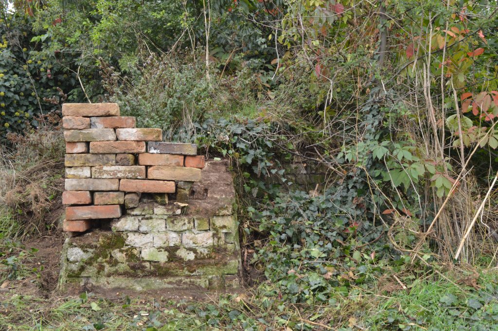
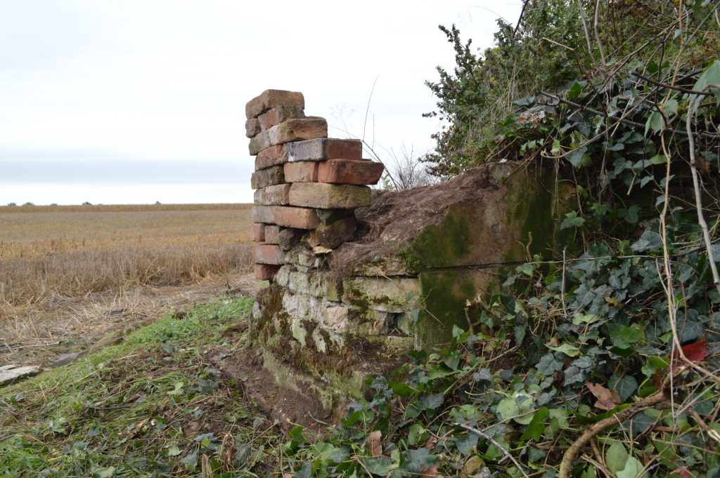
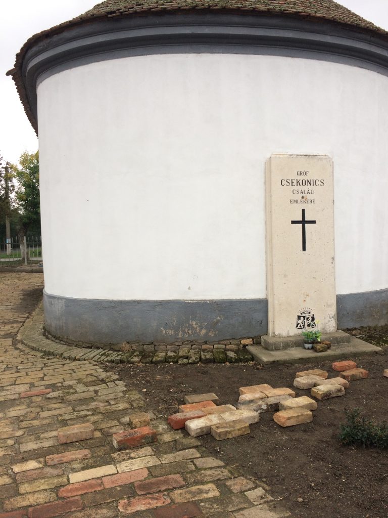
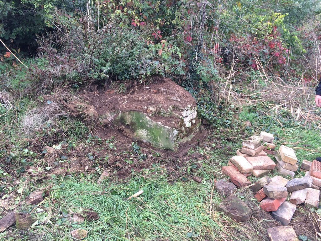
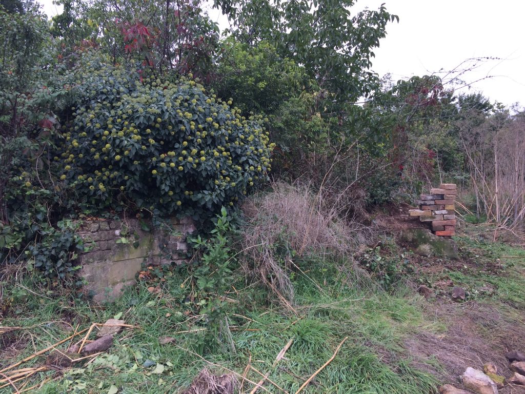
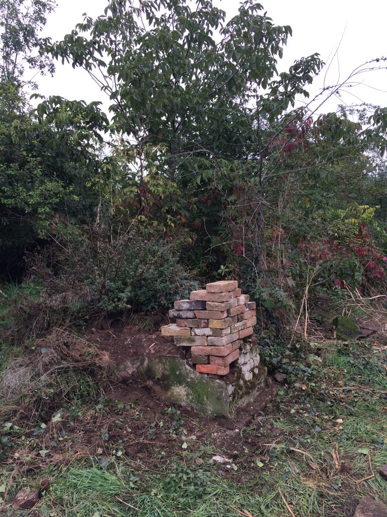
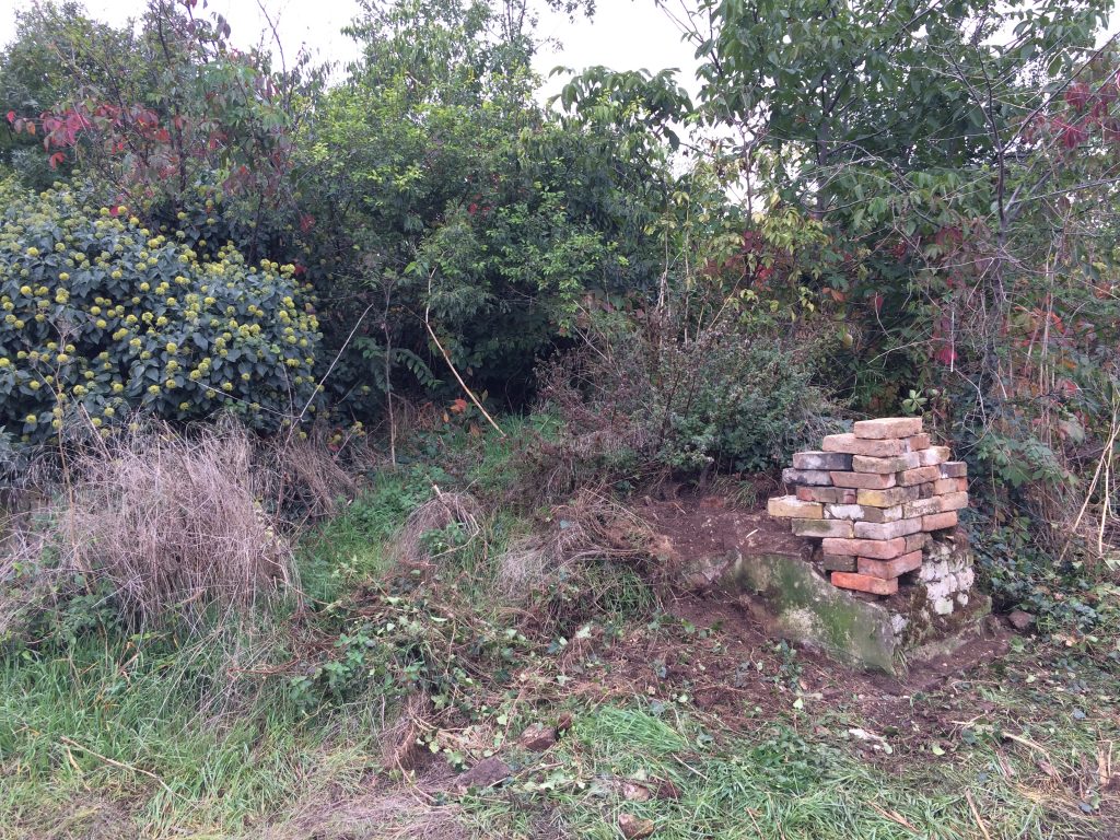
Our first intention is to work with the heritage of the late Csekonics counts. This noble family played a key role in the history of Jimbolia during almost 150 years since the first lord Csekonics got the village and the surrounding estates. The prosperity and importance brought by the Csekonics family led the region and Jimbolia itself became a regional industrial centre. This helped raise the new bourgeoisie, the owners of the two brick factories: the Bohn and the Muschong families. The storm of the 20th century finished both the Csekonics and the Bohn-Muschong stories, their heritage lost step by step by the lack of maintenance and interest. This way it became a built heritage in loss, sometimes already invisible.
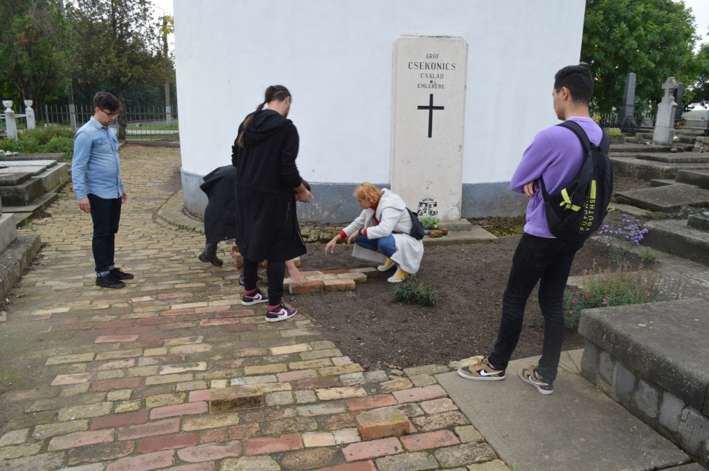
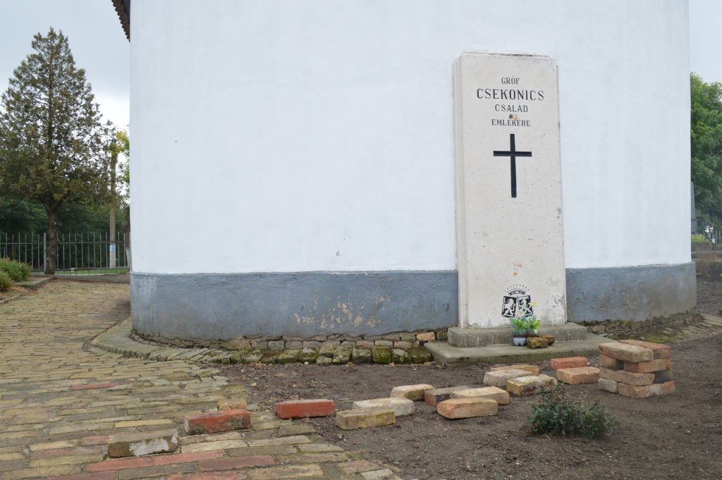
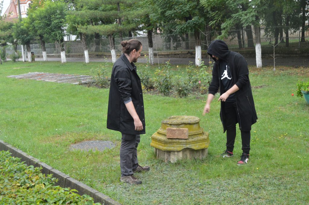
That’s why we pretend to work at the Csekonics heritage, walking around and finding traces – starting at the former town palace (now the consistory building) and heading towards the southern outskirts, where once the heart of all the Csekonics empire, the famous Csitó castle (designed by Miklós Ybl in 1868) stood. Nowadays there is almost nothing to find there, but hypothetically we have to find some visible traces within the small forested spot visible in the middle of the field. Also we hope to find traces and elements of the former castle all around the town – here our hypothesis is based on the experiences from all over our region: the people often actively participated in the demolition of the former noble mansions.
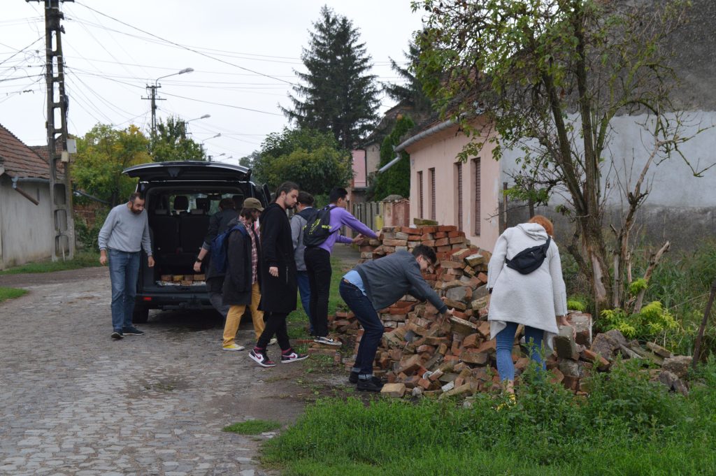
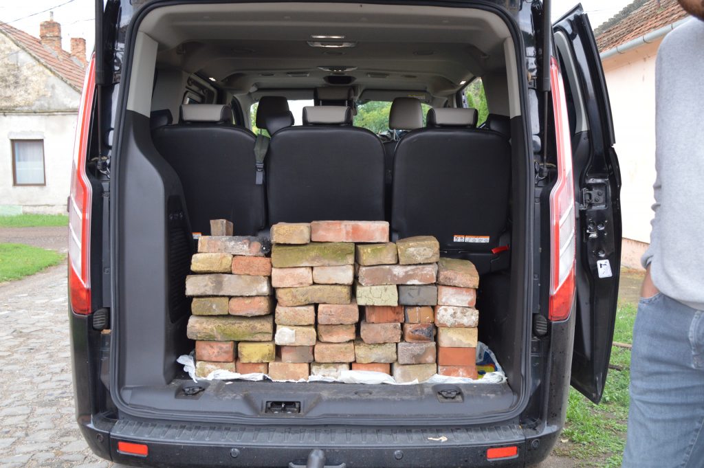
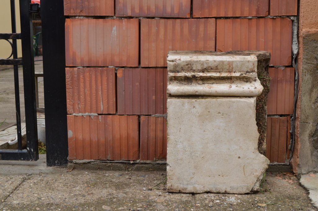
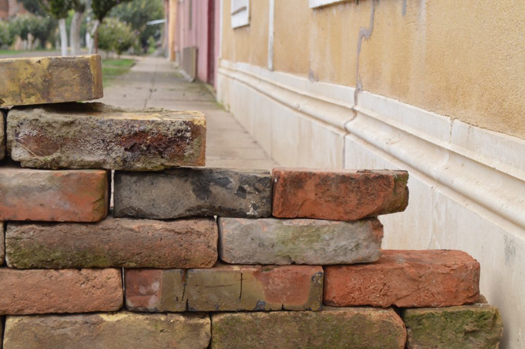
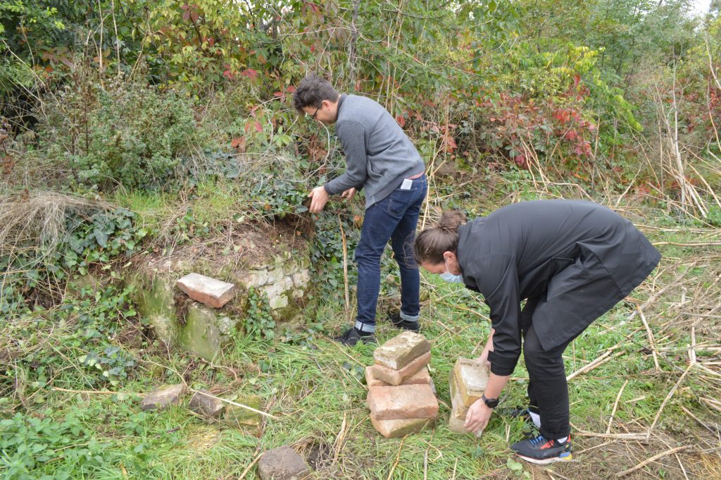
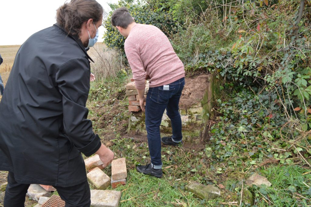
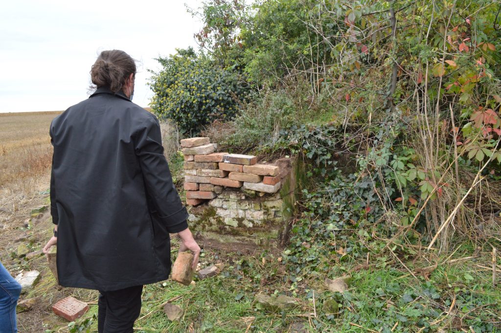
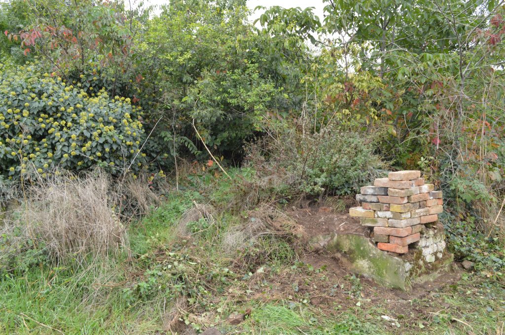
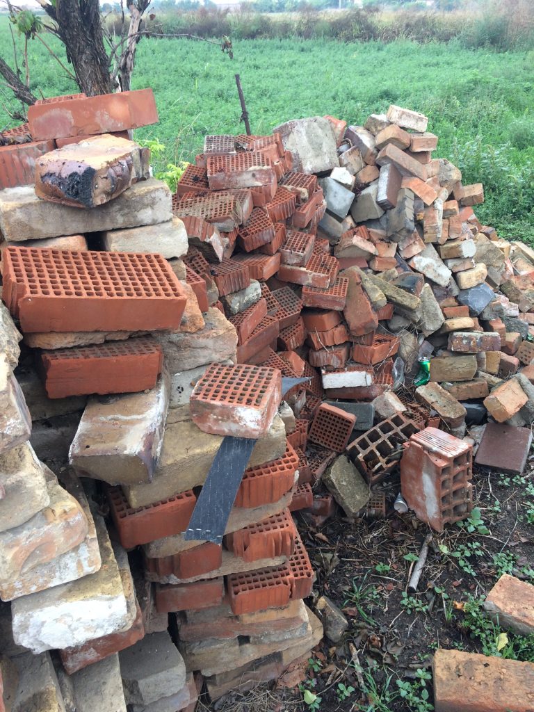
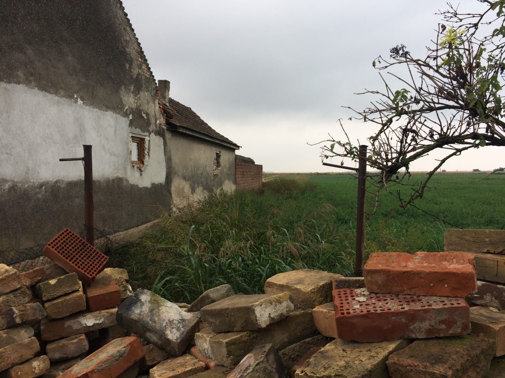
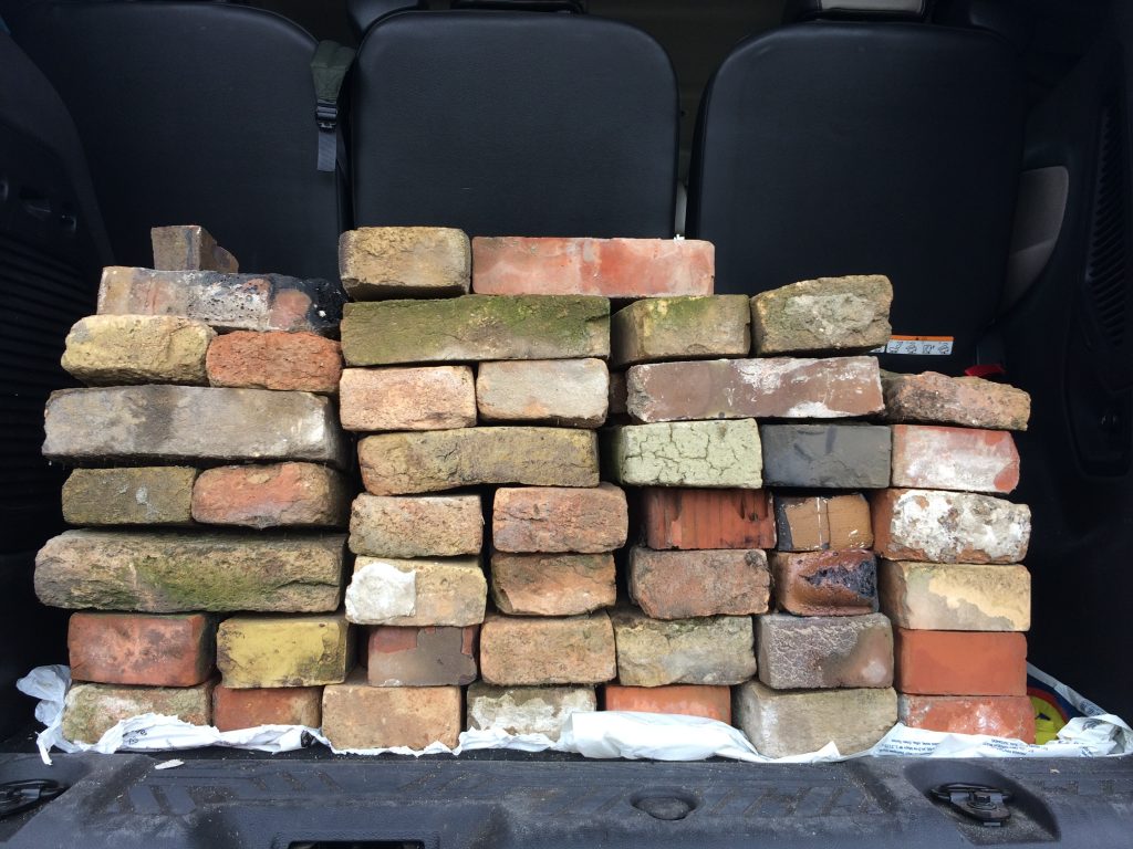
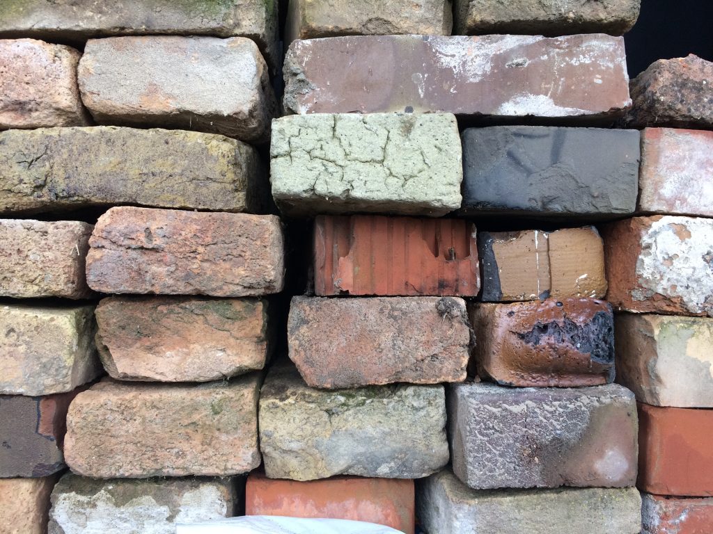
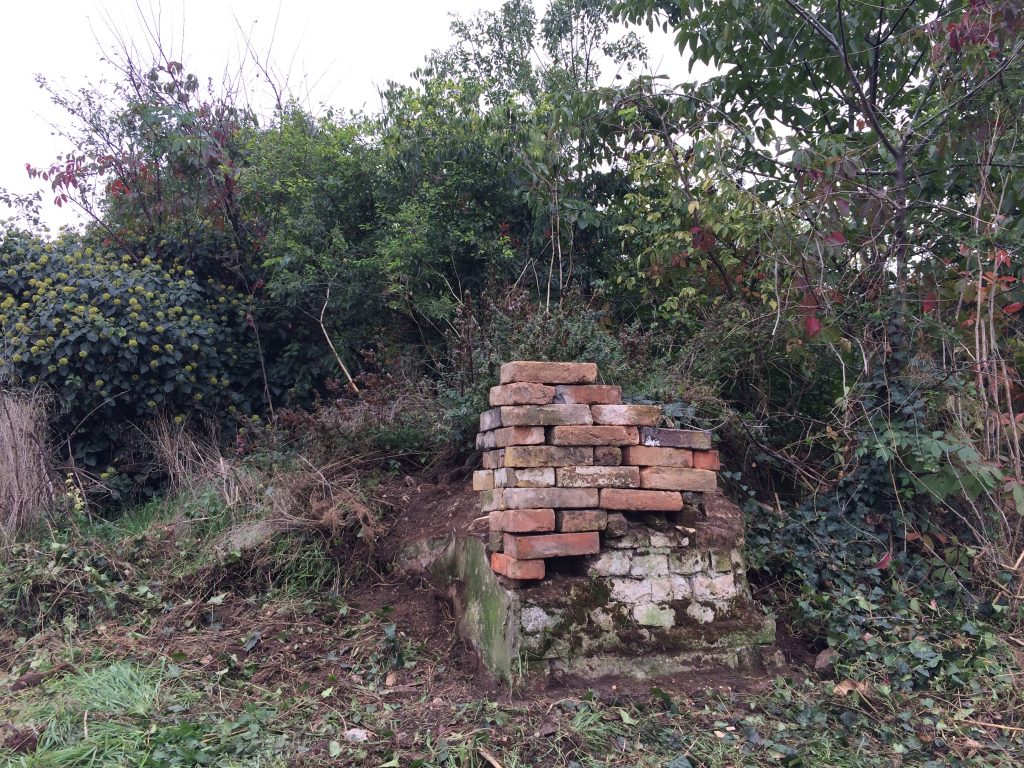
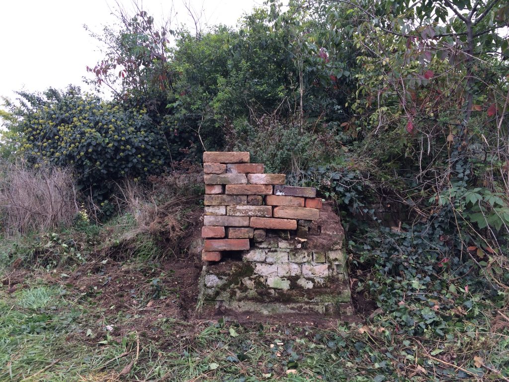
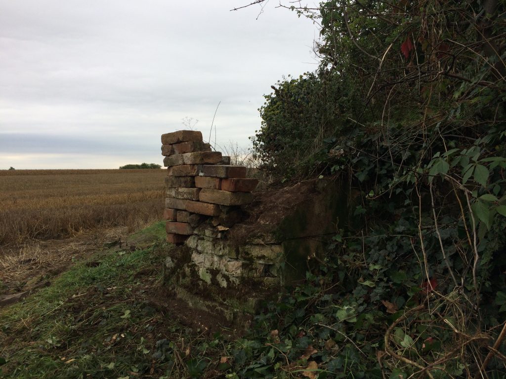
We pretend to visibilize the existing but sometimes invisible heritage of the Csekonics and the Bohn and Muschong families through small and action-like interventions, made by bricks collected all over the Futok neighborhood. With those bricks we will make small installations and after documenting the act and the result (with photos, videos etc.) we dismantle the installation and bring it to the next site, where we found another important piece to emphasize with our intervention.
Finally we also want to mention also that as our methodology is deeply based on the recognition and survey of the place it is key to have the local community involved in our projects in a certain way. They involvement help us not only to discover the real problems and issues of the design task (frequently very differents from what we see for a first sight) but also we can help them to be more conscious of their responsibility in how they can shape their life-spaces and what they can do for their environments and communities.
Chapter 4. Preparation of project communication
Teaching method: workshop
Duration: 420 min
At the end of the workshop students have to find the proper way of the documentation of their projects. The way of the documentation can express the concept of the idea. They have to choose the right tools and how to show the interventions for a person, who did not see the original ones.


Other Instructors
Gergely SÁGI
Doctoral Student
Levente SZABÓ
Professor
Zoltan MAJOR
Doctoral Student
Zsolt VASÁROS
Professor
Syllabus
The history of Jimbolia left us many different layers of built heritage which all are identical – not only as their original structure but also their transformation during the time kept important parts of the history. These layers are sometimes hidden or their story is forgotten, however they are parts of the common heritage of Jimbolia. To recognize these layers we make research on three different levels. These three levels are related to the level of the personal connection to the subject of the investigated context. The students can re-explore and recollect the lost or hidden stories due to the research and based on that try to continue these stories with architectural interventions. And if with our interventions we make the Jimbolia people more conscious about the values and stories of their built heritage we hope we can give back a part of its history to the local community.
O1.M3 INTERPRETING AND WORKING ON HERITAGE OBJECTS IN THEIR LANDSCAPE
O1.M3.02.02 Working with the (invisible) built heritage
Type of format
Workshop
Duration
Session 1 - 420 min 180 min workshop 60 min break 180 min workshop Session 2 - 420 min 180 min workshop 60 min break 180 min workshop Session 3 - 420 min 180 min workshop 60 min break 180 min workshop Session 4 - 420 min 180 min workshop 60 min break 180 min workshop
Possible connections (with other schools / presented topics)
DEB O1. M3.01. Recognition by small scale intervention
Main purpose & objectives
The main purpose of this class is to help students understand and recognize the importance and impact that borders make on our landscape, land use, the structure of our settlements and in general on our natural and built environment. We also try to hint the connection between the architectural/landscape scale side and the social/cultural side of this topic. The class introduces objective methods by which students can research and understand the nature of the borders and their imprints in our environment. We show the students how the wide scale of tools (eg. old maps, drawings, satellite pictures, LIDAR and photo 3D technology etc.) can help them to make their research more detailed and effective. According to our method, a deep understanding of the site is essential during the process of architectural design. Therefore, the design process starts with research. During this research, we collect information about the history, society, climate, economy, topography, nature, etc. of the site. We define the information as different layers of the place, which have connection and relation with each other. In order to find the starting point of the design, we have to find the connection among the layers. Because of the changing world and the various challenges, we have to continuously improve the methods of recognition and the way of information processing. The new technologies give opportunities to develop new methods of exploration of the sites and the new requests, like climate change, are made new design questions. So, the number of layers of places are constantly changing. We always need to find the relevant layers, which could lead to defining the real problems. As a result of this method, the students understand the context of the site and can find right questions and answers of the design. The recognition is made in three different levels which can describe the different ways one can understand the surrounding and its meanings. These three levels are related to the level of the personal connection to the subject of the investigated context. The first in this term is the level of the research on the material nature of the subject (in our case of the landscape/architectural context), the second is the social meaning attached to the subject of the investigation and the third level is the description of the personal narrative of the task and the information obtained from the previous research itself.
Skills acquired
Detailed theoretical knowledge regarding the context, the site and the importance of architectural and spatial heritage and existing and its impact on our natural and built environment. The ability to make deeper recognition with specific approaches and interventions, even as a first step of a design process, even as an interpretation tool to present a spatial situation to others.
Contents and teaching methods
1. Layers of recognition Teaching method: workshop 2. Interventions Teaching method: workshop 3. Interventions Teaching method: workshop 4. Preparation of project communication Teaching method: workshop
Reviews
Lorem Ipsn gravida nibh vel velit auctor aliquet. Aenean sollicitudin, lorem quis bibendum auci elit consequat ipsutis sem nibh id elit. Duis sed odio sit amet nibh vulputate cursus a sit amet mauris. Morbi accumsan ipsum velit. Nam nec tellus a odio tincidunt auctor a ornare odio. Sed non mauris vitae erat consequat auctor eu in elit.
Members
Lorem Ipsn gravida nibh vel velit auctor aliquet. Aenean sollicitudin, lorem quis bibendum auci elit consequat ipsutis sem nibh id elit. Duis sed odio sit amet nibh vulputate cursus a sit amet mauris. Morbi accumsan ipsum velit. Nam nec tellus a odio tincidunt auctor a ornare odio. Sed non mauris vitae erat consequat auctor eu in elit.